Volume 14 (1.1)/2022
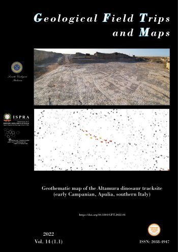
Geothematic map of the Altamura dinosaur tracksite (early Campanian, Apulia, southern Italy)
DOI: https://doi.org/10.3301/GFT.2022.01 - Pages: 1-19
Fabio Massimo Petti1,2, Matteo Antonelli3, Enrico Sacco3, Jacopo Conti1,3, Marco Petruzzelli4, Luigi Spalluto1, Stefano Cardia1, Vincenzo Festa1, Rafael La Perna1, Maria Marino1, Antonella Marsico1, Luisa Sabato1, Marcello Tropeano1, Giovanni Barracane4, Giovanni Montrone1, Arcangelo Piscitelli4 & Ruggero Francescangeli1
1Dipartimento di Scienze della Terra e Geoambientali, Università degli Studi di Bari Aldo Moro, Via Orabona, 4 - 70125 Bari, Italy.
2Muse – Museo delle Scienze di Trento – Corso del Lavoro e della Scienza, 3 -38122, Trento, Italy.
3Dipartimento di Scienze della Terra, Sapienza Università di Roma, Piazzale Aldo Moro, 5, I-00185 Rome, Italy.
4En.Su Environmental Surveys – c/o Dipartimento di Scienze della Terra e Geoambientali, Università degli Studi
di Bari Aldo Moro, Via Orabona, 4 - 70125 Bari, Italy.
Abstract
In 2019 a multidisciplinary study of the Altamura dinosaur tracksite (Apulia, southern Italy; early Campanian) was carried out to meticulously document its geological and palaeontological features. The goal was to pave the way for projects aimed at long-term conservation and valorisation of the geo-palaeontological heritage. For this purpose, a mapping of the whole track-bearing surface was performed, which led to the production of the first geothematic map (1:200) of the whole ichnosite. During the field activities, the surface was subdivided into 34 distinct sectors. For each sector, the work started with accurate manual and mechanical cleaning of the surface (industrial vacuum cleaner). The ichnological survey was carried out using standard methods (interpretative drawings with chalks to highlight outline and morphological features of each track). This approach was combined with close-range photogrammetry to obtain detailed 3D models of the best-preserved specimens. Finally, each sector was surveyed through aerial-based photogrammetry by means of sUAS (small Unmanned Aerial System). The aerial survey allowed us to gain a high-resolution and georeferenced orthophoto processed by using specific software. The field ichnological drawings occurring on each orthophoto were then traced and vectorised. The final step was the overlapping of each digitised sector and the processing of the tracksite map. The products of our study (geothematic map and 3D models of dinosaur tracks) highlight the extraordinary richness of the Altamura tracksite (26,000 footprints and 12 distinct trackways), confirming the high impact of new methodologies (close-range and aerial- based photogrammetry) as useful tools both for ichnological studies and future activities of public fruition of the geosite.
Keywords
dinosaur footprints, Late Cretaceous, Apulia Carbonate Platform, Aerial and Close-range Photogrammetry, sUAS – small Unmanned Aerial System.
