Volume 11 (2.2)/2019
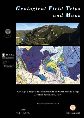
Geological map of the central part of Narni-Amelia Ridge (Central Apennines, Italy)
DOI: https://doi.org/10.3301/GFT.2019.04 - Pages: 1-26
Angelo Cipriani (1)
(1) - Dipartimento di Scienze della Terra, "Sapienza" Università di Roma. Piazzale Aldo Moro 5, 00185 – Roma (Italia).
Corresponding author e-mail: angelo.cipriani@uniroma1.it
Corresponding author e-mail: angelo.cipriani@uniroma1.it
Abstract
These explanatory notes are companion of a 1:12,500 geological map and present new stratigraphic and structural data gathered from the under-investigated Narni-Amelia Ridge (Central Apennines, Italy). Here Meso-Cenozoic rocks of the Umbria-Marche-Sabina sedimentary succession crop out, deeply influenced in its tectonic-stratigraphic evolution by the Early Jurassic Tethyan rifting. Geological mapping was accompanied by facies analysis and by a dense network of stratigraphic/sedimentologic logs.
Several Jurassic structural highs flanked by deeper-water basins were identified through palaeoescarpments analysis and allowed to reconstruct the Mesozoic palaeogeography of the study area.
Unexpected fine-grained calcarenites made up of neritic material were found embedded in the upper Pliensbachian-Bajocian deposits (sedimented after the drowning of the Calcare Massiccio carbonate platform), providing new data for restoring the Jurassic palaeogeography of the Central Apennines.
Evidence of an Early Cretaceous extensional phase, which is well-documented in the southernmost part of the Narni Ridge, was also recognized in the study area. Here the Marne a Fucoidi (Aptian-Albian) rest unconformably on the Hettangian shallow-water carbonates of the Calcare Massiccio, as a result of rejuvenation and erosion of the Early Jurassic margin of the Amelia intra-basinal high.
Keywords
Narni-Amelia Ridge, Umbria-Marche-Sabina sedimentary succession, syn-sedimentary tectonics, Jurassic, pelagic carbonate platform-basin systems, Cretaceous escarpments, Apenninic orogeny, Pliocene normal faulting.
